Field notes: the quarry lake that scored high until we found out who leased the shoreline
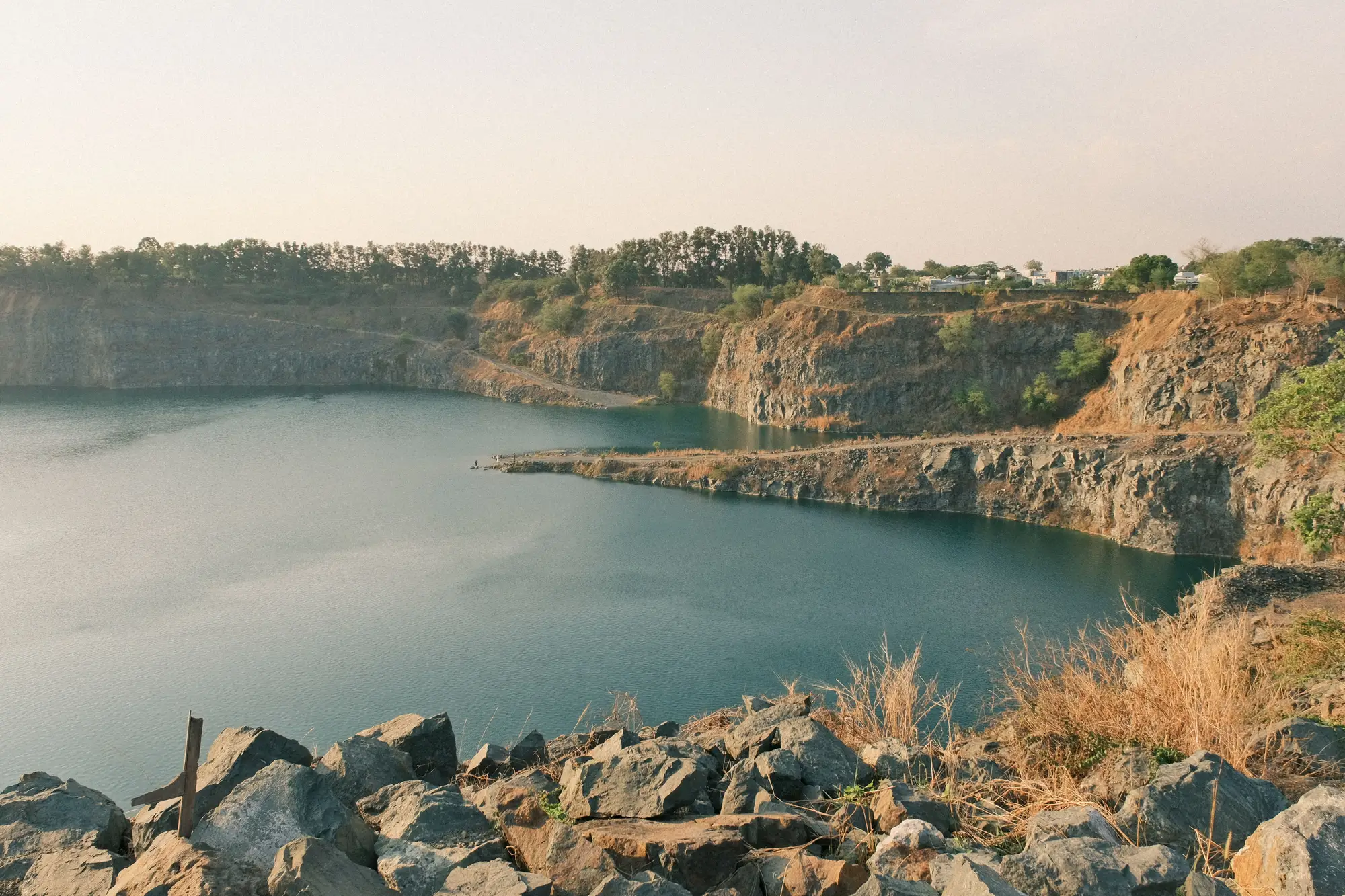
There's a flooded limestone quarry about forty minutes outside a mid-sized city I won't name, because the lesson matters more than the location. On paper it was close to ideal. Eleven hectares of open water, steep rock walls holding a level that barely moves between wet and dry season, minimal tree cover on three sides, and a county road running right along the north edge. A developer's screening list rarely hands you something this clean.
We flagged it early in a batch run last spring. Surface area, check. Level stability across the archive, check. Shading analysis came back almost boring, which in this business is a compliment. The only thing that gave us pause was shoreline access, and even that looked workable: a gravel apron on the south side wide enough for a laydown yard, no visible fencing, no structures crowding the water.
Then someone on the development side made a call to the county assessor's office, the way you do before you spend real money on a site visit. Turns out the quarry operator who sold the mineral rights twenty years ago kept a perpetual lease on the shoreline and the first fifteen meters of water for stormwater retention and future dewatering access. It's in the deed, not in anything a satellite can read. The lease doesn't expire until 2041. The water surface itself is unencumbered. The land you'd need to get a cable, a crane, or an anchor point to it is not.
This is the part of the job that doesn't show up in a resolution spec. A multispectral pass can tell you the water hasn't dropped more than a few centimeters in three years. It can tell you the eastern bank is in shadow past 3pm in December and doesn't matter much given the panel tilt you're planning. It cannot tell you that a shoreline was carved out of a sale twenty years ago by a lawyer who's probably retired by now, sitting in a filing cabinet in a county records office, invisible from four hundred kilometers up.
We've started treating quarry lakes a little differently than reservoirs for exactly this reason. A reservoir usually has one owner and one set of operating rules, even if they're a headache to track down. A quarry lake has a history. Somebody dug it, somebody flooded it, somebody sold it, and the paperwork from each of those transactions tends to survive longer than the people who signed it. Settling ponds have the same problem in a different shape: an industrial permit that restricts what touches the water, long after the plant that triggered the permit has changed hands twice.
None of that shows up on a candidate map by itself, and it shouldn't have to. What a good screening pass should do is get you to the short list fast enough that you have time left to make the one phone call that actually matters, the one to the assessor or the water authority, before you've committed engineering hours to a site that was never going to clear title. That's the whole point of ranking by the physical fundamentals first: surface area, stability, shading, access. We built the annual candidate maps on Floating Solar Screening around that order of operations on purpose, because a site that fails on water-level drift isn't worth anyone's legal review, and a site that passes on everything physical is exactly the one worth one more call before it goes on the shortlist.
The quarry's still on our list, by the way. Just lower, with a note.
If your own reservoir list has a few sites like that waiting to be found, that's what the annual screening run is for.