Field notes: the reservoir that ranked first on paper and dead last on the shoreline
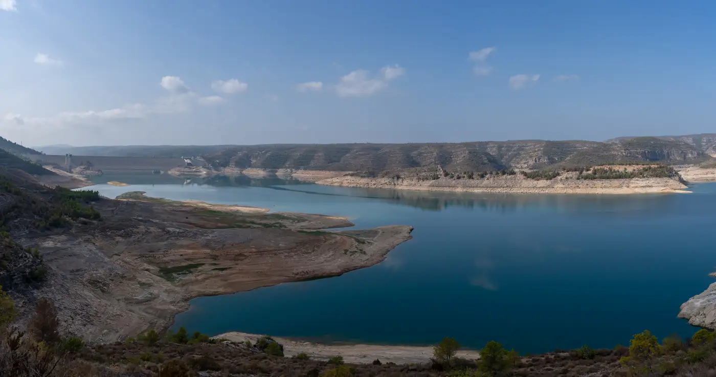
There's a reservoir in our regional portfolio that I still think about, mostly because it taught me not to trust a sorted spreadsheet as far as I could throw it.
On paper it had everything. Nine hundred acres of open water, almost no tree line to the south, irradiance numbers that made the engineering team happy, and a surface area big enough to hit a meaningful nameplate capacity without crowding the whole lake. It sat at the top of a screening list I'd built from public GIS layers and a few irradiance datasets stitched together over a long weekend. First pass, first place, no contest.
Then somebody actually drove out there.
The reservoir sits behind an irrigation district dam, and the district draws it down nearly fourteen feet between late June and early September to feed row crops downstream. Nobody flags that in a surface-area layer. The shoreline itself is a mix of quarried rock fill and a steep clay bank that slumps every spring, which meant the one spot wide enough for a laydown yard was also the spot the district uses to stage its own maintenance equipment three months a year. And the access road, the one that looked fine from above, turns to soup by April and stays that way until the frost finally lets go.
None of that shows up in a shapefile. All of it shows up the moment someone stands on the bank.
I bring this up because I think a lot of screening work quietly assumes that the easy-to-pull variables are the ones that matter most, mostly because they're the ones available without a site visit. Surface area, irradiance, maybe a rough slope estimate off a DEM. Those are real factors. They're just not the factors that kill a project. The things that kill a floating-PV project are almost always the ones that take a phone call or a boot print to find: a water-rights holder who draws the level down hard every summer, a shoreline too rocky or too silted for an anchor point, a reservoir that's technically public but functionally landlocked by private parcels on every bank with road frontage.
The frustrating part is that level stability and shoreline access aren't hidden information. They're just scattered. One piece lives in a water-rights database, another in a county parcel map, another in whoever happens to remember that the district drains the lake every summer because nobody wrote it down. Pulling all of that together for one reservoir is maybe an afternoon of digging. Pulling it together for the forty reservoirs on a regional candidate list is a month somebody doesn't have, which is exactly how a reservoir with a fourteen-foot seasonal swing ends up sitting at the top of a ranked list for three weeks before anyone notices.
What changed the way we do this screening pass wasn't finding better data. It was finding a way to look at level stability and shoreline condition for the whole candidate set at once instead of chasing it one water body at a time. We started running our regional lists through a yearly screening pass built for exactly this, checking surface area against shoreline access and level history before anyone commits engineering hours to a site visit. The reservoir that ranked first on paper didn't survive that pass, and it shouldn't have, but it took us a field trip to find that out the hard way the first time.
If your list has a reservoir sitting at the top for reasons that look a little too clean, it might be worth a second pass before it earns a third week at the top of the queue.