What is reservoir drawdown, and why does it decide your anchoring design?
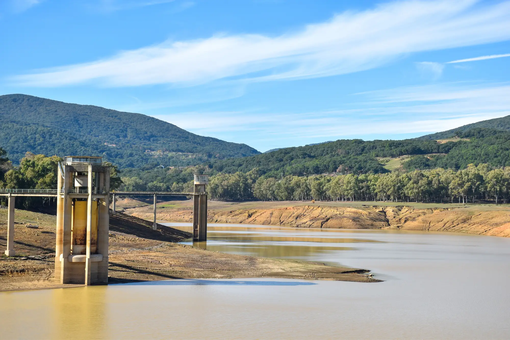
Drawdown is the vertical distance a reservoir's water surface moves between its highest operating level and its lowest, usually tracked over a full year or a multi-year cycle. A flood-control reservoir might sit near full pool for months and then drop hard during irrigation season. A municipal supply reservoir might hold a tighter band all year. A quarry lake left to fill and drain on rainfall alone can swing in ways nobody logged consistently. None of that shows up on a satellite basemap or a county parcel map. You find it in operating records, gauge data, or, if those don't exist for the water body you're looking at, in however many years of imagery you can get your hands on.
For a floating array, drawdown is the number that decides whether you need a simple catenary mooring or a winch-and-guide-rail system that lets the whole array ride up and down a slope of exposed bank twice a year.
Why anchor design starts with the water level, not the panel layout
Anchor lines on a floating array have to work across the full range between high pool and low pool, not just at whatever level the reservoir happened to be at when the site was scoped. At high pool, the lines need slack so the array can rise without pulling tight against the anchors. At low pool, the same lines need to hold the array in place without letting it swing into shallow water or ground out on newly exposed bottom. Get the drawdown range wrong and you end up with one of two failure modes: lines too short, so the array strains against its moorings during a flood release, or lines too long, so the array drifts and the walkways twist at the connectors during a dry spell.
Shoreline access cabling has the same problem in miniature. The cable run from the array to the inverter or the grid connection point has to flex with the water line. A reservoir that only moves a meter or two needs a modest service loop. A reservoir with several meters of annual swing needs a cable management system built for it, plus a longer stretch of shoreline kept clear for the slack to live in. If the shoreline is steep or rocky at low pool, that clearance gets harder to hold, and the access point you scoped at full pool might not exist at the low end of the cycle.
Reading a reservoir's level history before you commit to a design
The honest version of this work is pulling water-level records for the specific reservoir, cross-referencing them against bathymetry if it exists, and checking shoreline conditions at both pool extremes. That's straightforward for a single site. It gets slow once you're trying to rank a dozen or two dozen candidate water bodies across a service territory, because each one means a separate records request, a separate gauge dataset if one even exists, and a separate judgment call on how stable the level actually is.
That's the stage where a lot of otherwise promising reservoirs get dropped for the wrong reason. Confirming the drawdown picture takes too long, so the candidate falls off the list before anyone finds out whether the drawdown itself would have been fine to design around. A quarry lake with a stable level and easy shoreline access can lose out to a reservoir with worse drawdown simply because its records were easier to find.
Multispectral satellite imagery, pulled across the available history for a water body, can show the water line moving across seasons and years without a records request filed per site. Floating Solar Screening builds that into a per-water-body candidate map, covering surface area, level stability, shading and shoreline access together, so a drawdown problem on one reservoir shows up next to a shoreline access problem on another instead of surfacing one at a time as separate engineering tasks.
What this means for a candidate list
A reservoir with a tight, predictable level band is usually the easier anchoring job. A reservoir with a wide seasonal swing isn't automatically disqualified. It just means the mooring and cabling budget needs to account for that swing from the start, not get discovered mid-design when a crew shows up at low pool and finds the access point underwater or the opposite.
If you're ranking reservoirs, quarry lakes or settling ponds for floating-PV potential and want the drawdown picture alongside surface area and shading in one pass, that's what this site is built to screen for.